

On the eve of winter in the Northern Hemisphere, heavy jackets, gloves and hats have returned to the closet in recent weeks in cities like Washington and New York. The cold around 0°C, which had been common since the end of November in the United States, gave way to several days with higher temperatures, reaching 18°C.
In other parts of the country, the rise in the thermometer has been greater. A heat wave hits Central America and makes states like Oklahoma, Missouri and Illinois live with temperatures around 10°C higher than expected for December; in Iowa, there were records of up to 20°C above the average.
The climate crisis also leads to storms and catastrophes, such as the series of tornadoes that killed more than 80 people in the Kentucky region last weekend. This Thursday (16), winds of more than 100 km/h left at least five dead between Nebraska, Kansas and Iowa.
A little further north, although heavy snowfalls are infrequent, December usually sees a fair amount of snowfall two or three times — in New York, exactly a year ago, the scene was whitewashed streets. Until this Thursday (16), however, neither NY nor Chicago, for example, had registered any day of the month with measurable rainfall (capable of accumulating a layer of more than 2.5 cm of snow on the ground)
On Wednesday (15), by the way, Chicago registered a record temperature for December, with 20.5°C.
The occurrence of a warmer December in the US is linked to several factors, including global warming. According to data from the NOAA (National Administration of Atmosphere and Oceans), the US federal agency for climate studies, the planet has just faced the fourth hottest November since 1880, when the record began to be made.
The month — of late autumn in the Northern Hemisphere and spring in the South — was 0.91°C warmer than the 20th-century average of 12.9°C. This advance has been taking place since the 1980s, and scientists attribute the rise to human action, citing the emission of pollutants and deforestation.
“Many factors generated Friday’s tornadoes [10]. But if you look at trends over the last 20 to 30 years, these events are becoming more common than ever in the South-Central US region. And there’s evidence that climate change has an impact on that,” says Trent Okerson, a WPSD TV meteorologist in Kentucky.
“It is not possible to directly link a storm to it, but the trend towards more storms of this type certainly exists.”
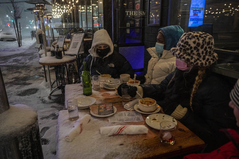
Comparison shows tourists in a restaurant in New York this Thursday (16), on a mild day, and after a snowfall on December 16 of last year – Jeenah Moon – 16.Dec.21/Reuters and Hiroko Masuike – 16.Dec.20/The New York Times
According to the meteorologist, indicators point out that last week’s harsh weather is also related to the record heat in water temperatures in the Gulf of Mexico. “This helps to transport more moisture towards the south-central US. A warmer climate brings in more moisture, which creates more storms and more opportunity for tornadoes.”
Heat increases the risk of mega-storms, common in summer but not then. Time closes when warm air collides with another mass of cold air. And, the more hot air, the more rain and wind can occur.
In recent days, winds of more than 95 km/h, hit cities like Denver (Colorado) and Des Moines (Iowa), generating problems such as power outages. And states like Minnesota and South Dakota had tornado alerts in December for the first time in history. Weather services have been issuing a high number of storm alerts: last week there were around 1,000 across the country.
The most serious case occurred between days 10 and 11, when tornadoes hit Kentucky, Arkansas, Tennessee and Missouri, on a route of more than 300 km. Cities were destroyed and a factory collapsed entirely. At least 88 people died.
Another aggravating factor is the La Niña phenomenon, which has returned, making the water surface of the North Pacific Ocean cooler than normal. Among the effects on the planet’s climate, which include harsh winters and droughts, is an air current that crosses the US from west to east and forms a barrier to cold air coming from the north pole. This makes much of the country have a warmer winter.
The forecast for the rest of the season remains open, and meteorologists say there may be a kind of roller coaster effect, with muggy weeks alternating with more freezing weather. Thus, a snowy Christmas in more cities is not entirely out of the question.
It is worth remembering that earlier this year, the US had an above-average cold winter, with blizzards even in generally warm places like Texas. The lack of preparation for the cold caused several problems in the state, such as a lack of electricity and the shutdown of oil refineries.
.


