

Snowstorms occurred earlier in the mountains and semi-mountains of Attica – The phenomena are expected to subside gradually
The bad weather is at its peak today, Tuesday, according to the latest forecast data from meteo.gr / Athens National Observatory.
Rain and sporadic storms are expected until the evening in low-altitude areas of Magnesia, Central and Eastern Mainland, Eastern Peloponnese, Evia, Crete and the islands of the Central and South Aegean. Snowfall will occur in mountainous and semi-mountainous parts of Magnesia, Central and Eastern Mainland, Peloponnese, Evia and Crete.
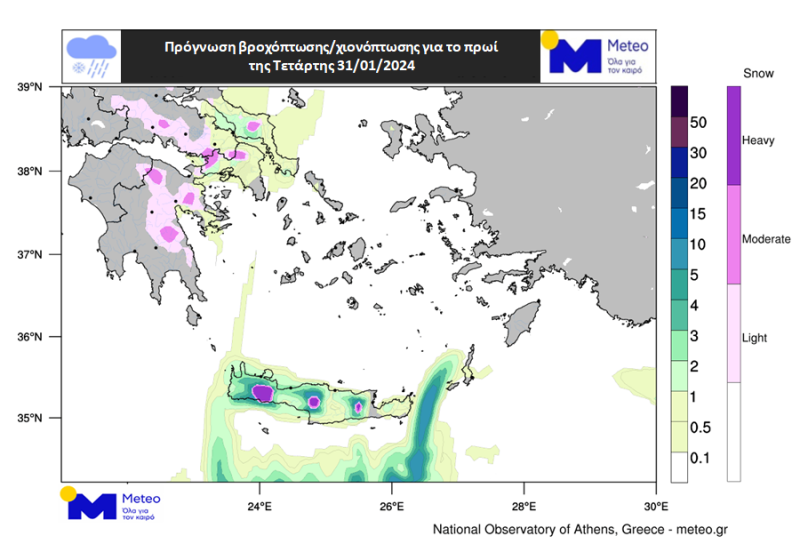
Afterwards the phenomena will present a significant gradual weakening and from the morning of Wednesday 31/01 they will be limited to Eastern Sterea and Peloponnese, Evia and mainly Crete.
Earlier, snow storms occurred in the mountains and semi-mountains of Attica and a storm in Athens.
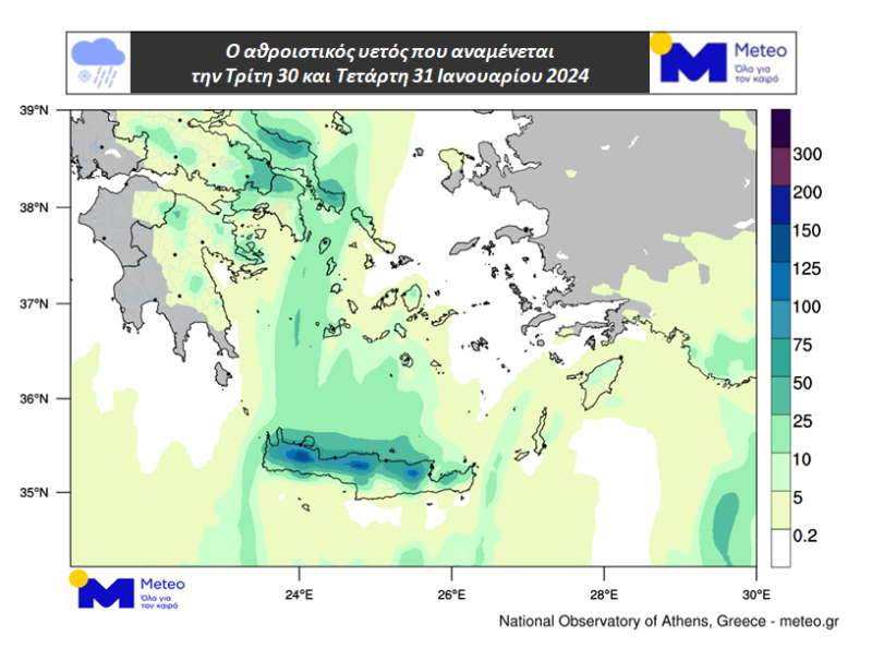
Maps 1 and 2 show the precipitation (shades of green) and snowfall (shades of purple) expected on the afternoon of Tuesday 30/01 and the morning of Wednesday 31/01. Map 3 shows the cumulative precipitation (rain / snow) expected on Tuesday 30/01 and Wednesday 31/01.
The north winds in the Aegean they will reach on Tuesday 30/01 8 Beaufort and in places 9 Beaufort while they will show a slight weakening on Wednesday 31/01. In the Ionian the winds will not exceed 5 to 6 Beaufort. The temperature that on Tuesday 30/01 will not exceed 9 to 12 degrees Celsius will show a slight increase on Wednesday 31/01, mainly in the northern continental areas.
Source: Skai
I have worked as a journalist for over 10 years, and my work has been featured on many different news websites. I am also an author, and my work has been published in several books. I specialize in opinion writing, and I often write about current events and controversial topics. I am a very well-rounded writer, and I have a lot of experience in different areas of journalism. I am a very hard worker, and I am always willing to put in the extra effort to get the job done.


