

Researchers were in Cape Verde and the Barbados Islands to make the necessary measurements that will confirm the EarthCARE satellite data
Scientists from around the world manned numerous missions on planes, ships and ground stations, flew and logged thousands of hours at sea in the Atlantic Ocean, often under adverse conditions, with the aim of validating the satellite’s observations EarthCARE. Two young Greek researchers from the National Observatory of Athens also participated in these missions Easter dove and the Dimitra Kouklakis.
The satellite EarthCAREwhich is a joint venture between him European Space Agency (ESA) and her Japan Aerospace Exploration Agency (JAXA), launched on May 29, 2024, with the goal of understanding the interaction between clouds, aerosols and radiation in the Earth’s atmosphere and ultimately, better forecasting weather and climate conditions. The measurements are made using four scientific instruments, a high spectral resolution lidar, a cloud radar, a multispectral imager and a broadband radiometer. But how accurate are these measurements? The calibration of the satellite and the control of the accuracy of its results, with parallel measurements on Earth, have been undertaken by scientists from all over the world through a series of missions. In this verification the Institute of Astronomy, Astrophysics, Space Applications and Remote Sensing (IAADET) of the National Observatory of Athens also participatesn.
In the framework of the program “ORCHESTRA“, whose main objective is to verify the results of EarthCARE, scientific teams were in Cape Verde and the Barbados islands, in the Atlantic Ocean, to make the necessary measurements that will confirm the satellite data and indeed the time the satellite was passing above them.
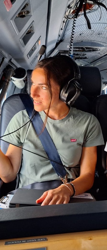
The PhD student and collaborator of the National Observatory of Athens, Easter doveparticipated for six weeks in an expedition of 28 scientists on the research vessel “Meteor Research Vessel»which started in Cape Verde and ended in Barbados. Weather conditions were often difficult. Besides, the ship was inside the intratropical convergence zone, an area of low barometric pressure responsible for intense storms, winds and tropical cyclones. “But not something too difficult so that we need to be on the alert or have to change our direction to avoid a typhoon or cyclone,” she describes to APE-MPE.
Ms. Pashou was tasked with operating a lidar instrument for shipboard monitoring of aerosols, clouds and atmospheric parameters such as temperature and relative humidity. These measurements aim to compare and validate the results of the corresponding lidar carried by the EarthCARE satellite. However, her day-to-day life also included many other responsibilities, such as the daily performance check of the instrument and its maintenance.
“The lidar system we had on board was transferred from the Max Planck Institute of Hamburg in Cape Verde in a container and it went through a lot in transit, so we had to first identify what might have changed and calibrate it to achieve the same quality readings it did before it was transported. However, there were no unsolvable problems, the expected problems occurred when a system has made such a journey. The next few weeks went more smoothly, we always had a daily check of the system to make sure it is counting correctly and everything is working as it should. Afterwards, we analyzed the measurements to check the reliability of the instrument”, explains Ms. Pashou.
A critical moment of the mission was when the satellite passed close by the research ship, so “we had to make sure that the instrument would continue to measure and there would be no interruption, in order to have simultaneous measurements with both the satellite and the research aircraft” , as she emphasizes.
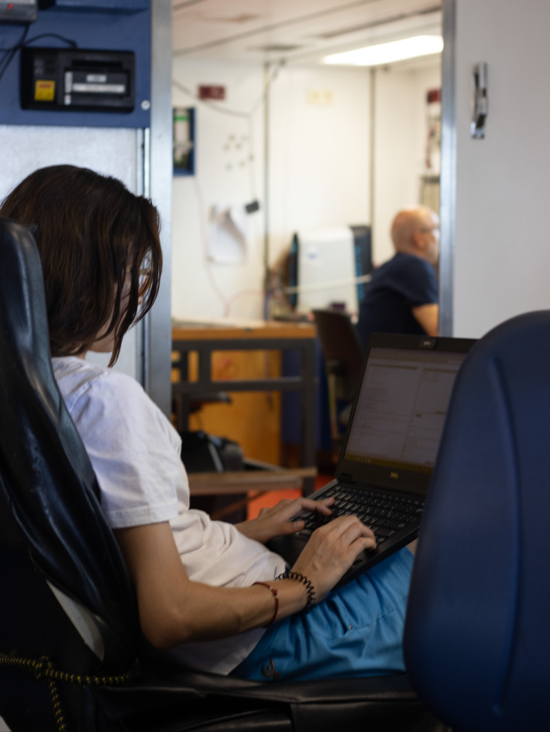
So, at the same time that the research ship was sailing in the ocean, another scientific team was flying directly above it with the German Space Agency’s “DLR HALO” aircraft making parallel measurements of solar radiation, aerosols and clouds. In this group was the doctoral student and collaborator of the Observatory, Dimitra Kouklakis.
This mission lasted two months. During the first month the flights had as their point of departure and arrival point Cape Verde, while during the second the focus was on Barbados. As Mrs. Kouklakis, who participated in the second part of the mission, emphasizes to APE-MPE, “the flight plan was different every time and was determined by the atmospheric conditions, by the meteorological forecasts, by the orbit of the satellite and by its location research ship”.
During her ten-day participation in the mission, Dimitra Kouklakis took part in a nine-hour flight from Barbados heading southeast, along with six other scientists, “in order to record with lidar, radar, radiation measuring instruments and dropsondes atmospheric concentrations of aerosols, humidity, cloud composition , radiation, temperature and pressure, i.e. all the atmospheric parameters we use in climate models”
The rest of the time he participated in the preparation of flights and equipment. “The truth is that for me, who was the first time to participate in such an experiment in an aircraft, it was a very special experience. The challenge was if something goes wrong, how will we be able to act quickly, coolly and efficiently, so as not to lose time and valuable measurements”, he recalls clarifying that during that period “the weather conditions were mild, we did not encounter anything extreme”.
Mrs. Kouklakis particularly stands out the moment the aircraft passed over the ship. “It is important to analyze remote sensing data from different angles. So having measurements from different points helps us get better resolution at some altitudes and better data quality.”
This simultaneous work of so many scientific groups with aircraft and ships and with the use of sophisticated instruments that measured the same time from different altitudes and points is for Ms. Kouklakis the great value of this particular mission. “You have a time series of data with a lot of information to estimate radiation that has very important implications for climate change. Also, there is an exchange of know-how and knowledge from the scientific groups and all these will come together to become one for the benefit of all of us. Some of these processes and phenomena do not only concern the tropics, there are some phenomena such as the interaction of dust with radiation that are very applicable in Greece and the Mediterranean in general, where we have a very large transport of dust”, he explains.
Peristera Paschou adds for her part that “we intend to use the data also for research purposes and to deepen our knowledge of how aerosols interact with clouds and solar radiation, which affects weather and climate, but and how these measurements can improve weather and climate models.”
The IAADET will implement the ACROSS experimental campaign in the Mediterranean in the summer of 2026, where, with a focus on Greece, instruments will be placed for the calibration and verification of EarthCARE observations. Its research aircraft will also participate in this experiment NASA.
THE Vassilis Amoiridisresearch director of IAADET, points out to APE-MPE that in the Mediterranean “things are more complicated than in the Atlantic”. “In the Atlantic there can be hurricanes, but in terms of atmospheric composition the conditions are simpler than in the Mediterranean, since we encounter desert dust and marine suspensions, as well as smoke from fires. He doesn’t have anything else. Anthropogenic activities, pollen, microplastics are involved in the Mediterranean. Each Mediterranean country has different laws and regulatory frameworks for emissions since many countries belong to different continents. The Mediterranean is the crossroads of air masses, it has desert dust, smoke from wildfires, ash from volcanoes, man-made activities and even wars that change land uses and people’s activities. All these factors affect the atmosphere and by extension the weather and climate. So the Mediterranean will be the big test for the EarthCARE satellite.”
It is noted that IAADET has significant expertise in the calibration and verification of mission results. Eleni Marinou, a colleague of the National Observatory of Athens, also participates in ESA’s international DISC team for strengthening the scientific performance of the mission and exploiting its results. Also, Vassilis Amoiridis and Eleni Marinou have undertaken the coordination of the writing of good practices in the calibration of modern satellite systems. The manual is under review by the International Committee on Earth Observation Satellites CEOS.
Source: Skai
I have worked as a journalist for over 10 years, and my work has been featured on many different news websites. I am also an author, and my work has been published in several books. I specialize in opinion writing, and I often write about current events and controversial topics. I am a very well-rounded writer, and I have a lot of experience in different areas of journalism. I am a very hard worker, and I am always willing to put in the extra effort to get the job done.


