

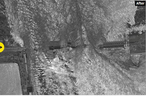
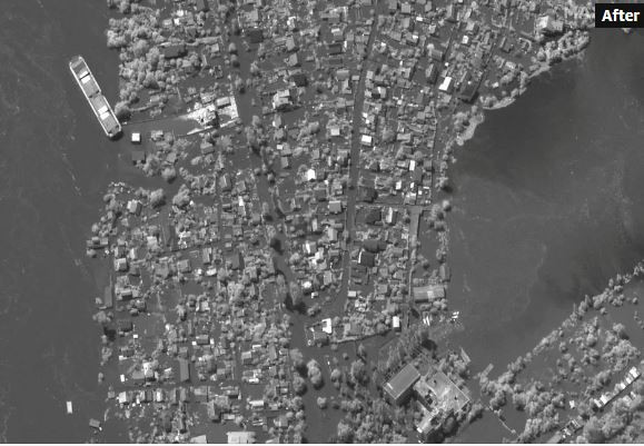
Images show houses and buildings submerged in water. In many cases, only the roofs of the houses can be seen, while parks, stadiums and other infrastructures have been flooded
Ukraine and Russia continue to trade accusations a day after the explosion at the Kakhovka dam as thousands of citizens were told to evacuate their settlements as water overflowed the dam and turned roads into “rivers”.
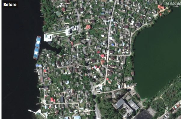
Satellite images from Ukraine, provided by Maxar Technologies, revealed the extent of the destruction at the dam.
Before the explosion
After the explosion
Images show houses and buildings submerged in water. In many cases, only the roofs of the houses can be seen, while parks, stadiums and other infrastructures have been flooded.
Before
After
The water level recedes
At the same time water levels in the town of Nova Kahovka have started to drop after the nearby dam was destroyed, the Russian-installed town administration said via the Telegram messaging app.
“The water level in the flooded streets of Nova Kahovka has started to recede,” said the administration of the now Moscow-controlled city in occupied Ukraine.
Despite the fact that the waters have started receding 24 hours after the collapse of the dam, the damage caused by the floods in the area is significant and it is expected to take time to restore them.
Source :Skai
With a wealth of experience honed over 4+ years in journalism, I bring a seasoned voice to the world of news. Currently, I work as a freelance writer and editor, always seeking new opportunities to tell compelling stories in the field of world news.


